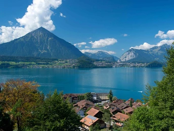
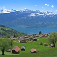
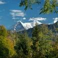
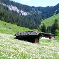
\n<\/svg>\n<\/svg>","city":"\n<\/svg>\n<\/svg>","convention":"\n<\/svg>\n<\/svg>","event":"\n<\/svg>\n<\/svg>","gastro":"\n<\/svg>\n<\/svg>","hotel":"\n<\/svg>\n<\/svg>","package":"\n<\/svg>\n<\/svg>","poi":"\n<\/svg>\n<\/svg>","tour":"\n<\/svg>\n<\/svg>","webcam":"\n<\/svg>\n<\/svg>","pages":"\n<\/svg>\n<\/svg>","storytelling":"\n<\/svg>\n<\/svg>","skiresort":"\n<\/svg>\n<\/svg>","sledge":"\n<\/svg>\n<\/svg>","sledge-20":"\n<\/svg>\n<\/svg>","sledge-40":"\n<\/svg>\n<\/svg>","sledge-60":"\n<\/svg>\n<\/svg>","sledge-80":"\n<\/svg>\n<\/svg>","sledge-100":"\n<\/svg>\n<\/svg>","trail":"\n<\/svg>\n<\/svg>","trail-20":"\n<\/svg>\n<\/svg>","trail-40":"\n<\/svg>\n<\/svg>","trail-60":"\n<\/svg>\n<\/svg>","trail-80":"\n<\/svg>\n<\/svg>","trail-100":"\n<\/svg>\n<\/svg>","slope":"\n<\/svg>\n<\/svg>","slope-20":"\n<\/svg>\n<\/svg>","slope-40":"\n<\/svg>\n<\/svg>","slope-60":"\n<\/svg>\n<\/svg>","slope-80":"\n<\/svg>\n<\/svg>","slope-100":"\n<\/svg>\n<\/svg>","hiking":"\n<\/svg>\n<\/svg>","hiking-20":"\n<\/svg>\n<\/svg>","hiking-40":"\n<\/svg>\n<\/svg>","hiking-60":"\n<\/svg>\n<\/svg>","hiking-80":"\n<\/svg>\n<\/svg>","hiking-100":"\n<\/svg>\n<\/svg>","lift":"\n<\/svg>\n"}Photos & MapRoute How would you like to arrive? By carBy public transportDescriptionGood to knowNearbyGPX Download GPX file Download tourDownload reverse tourDownload tour with return tripDownload reverse tour with return trip05:40 h1,160 m680 m566 m1,679 m1,113 m14.88 kmStart: Merligen, BeatusDestination: Innereriz, Säge The route starts at the STI bus stop “Merligen Beatus” and heads into the village. Following the Grönbach, it then continues through the woodland along well-surfaced tarred tracks. On the track up to Gütsch, the gaps in the trees afford a splendid view of the Lake Thun region and the Niesen. The flanks of the Sigriswilergrat and Güggisgrat climb steeply at the entrance to the Justis valley. The well-surfaced tracks at the entrance to the valley are also lined with huge rocks and boulders, which have broken away from this impressive ridge. The hike continues to “Gross Mittelberg” and “Hinterstberg” via “Püfel”. This stretch is relatively flat and follows a well-maintained path towards the valley. Next comes the climb to Sichle itself, which can already be seen rising up majestically in the background as you enter the valley. At the last alpine farm you can enjoy a quick snack before setting off on the mountain trail. Some will have to stop to catch their breath from time to time on the scrabbly ascent up the mountain. The mountain trail continues to narrow as it approaches “Sichle”. At the top, the pass opens up onto a narrow arête between two peaks with views of the Emmental hills and the Bernese Oberland with the angular Niesen and the Frutigland. A narrow path crosses the meadow from “Sichle” down towards the Eriztal valley. Afterwards, the going becomes rocky and stony, and several gullies have to be negotiated before you reach “Obere Schörizhütte”. From there you can also marvel at the multiple faces of the “Sieben Hengste” mountain. Via “Untere Schörizhütte” a variety of paved and unpaved tracks take you to the Restaurant Säge in Innereriz, where you will also find an STI bus stop (also marked “Innereriz”). Read moreBerner Wanderwege Good to know Best to visitsuitableDepends on weatherJanFebMarAprMayJunJulAugSepOctNovDecDirections Merligen - Grön - Hinterberg - Sichle - Oberschöriz - Innereriz/Säge Read moreEquipment Wir empfehlen folgende Ausrüstung: Feste Bergschuhe, mittelgrosser Rucksack mit Hüftgurt, Sonnenschutz, Regenbekleidung, Wanderstöcke, Taschenapotheke, Picknick, genügend Flüssigkeit, Mobiltelefon. Read moreDirections & Parking facilities Getting there: Take STI bus no. 21 from Thun station to Merligen, BeatusGetting back: Take STI bus no. 41 from Innereriz, Säge to Thun stationRead moreAdditional information Verein Berner Wanderwege, Bern, Tel.: 031 340 01 01, E-Mail: info@beww.ch, Homepage: www.bernerwanderwege.ch Read moreSafety guidelines Diese Route verläuft ganz oder teilweise auf signalisierten Wegen der Kategorie Bergwanderweg. Read moreMapSwisstopo Wanderkarte 254T Interlaken 1:50’000Read more Nearby View on map Place of interestBEATUS Wellness & Spa Hotel fitness Merligen tourist office Tourist Information Opens at 07:00 Merligen Lido outdoor swimming pools Tours 5.42 km Niederhorn - Wanderung mit traumhaften Aussichten Hiking Trail 7.97 km Über die Einseilhängebrücke nach Beatenberg Hiking Trail 7.61 km Niederhorn - Rischerental Hiking Trail outdooractiveThis website uses technologies and content from the Outdooractive platform. Getting there Through the tranquil Justis valley and over Sichle into ErizSigriswilTravel by public transportTravel by car JanuaryFebruaryMarchAprilMayJuneJulyAugustSeptemberOctoberNovemberDecember MoTuWeThFrSaSu 303112345678910111213141516171819202122232425262728293031123456789JanuaryFebruaryMarchAprilMayJuneJulyAugustSeptemberOctoberNovemberDecember MoTuWeThFrSaSu 303112345678910111213141516171819202122232425262728293031123456789
How would you like to arrive?
Download GPX file
Download tour
Download reverse tour
Download tour with return trip
Download reverse tour with return trip
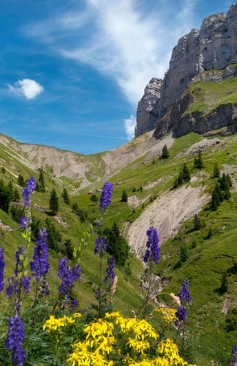
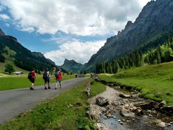
The flanks of the Sigriswilergrat and Güggisgrat climb steeply at the entrance to the Justis valley. The well-surfaced tracks at the entrance to the valley are also lined with huge rocks and boulders, which have broken away from this impressive ridge. The hike continues to “Gross Mittelberg” and “Hinterstberg” via “Püfel”. This stretch is relatively flat and follows a well-maintained path towards the valley. Next comes the climb to Sichle itself, which can already be seen rising up majestically in the background as you enter the valley. At the last alpine farm you can enjoy a quick snack before setting off on the mountain trail. Some will have to stop to catch their breath from time to time on the scrabbly ascent up the mountain. The mountain trail continues to narrow as it approaches “Sichle”. At the top, the pass opens up onto a narrow arête between two peaks with views of the Emmental hills and the Bernese Oberland with the angular Niesen and the Frutigland. A narrow path crosses the meadow from “Sichle” down towards the Eriztal valley. Afterwards, the going becomes rocky and stony, and several gullies have to be negotiated before you reach “Obere Schörizhütte”. From there you can also marvel at the multiple faces of the “Sieben Hengste” mountain. Via “Untere Schörizhütte” a variety of paved and unpaved tracks take you to the Restaurant Säge in Innereriz, where you will also find an STI bus stop (also marked “Innereriz”).
Best to visit
Directions
Equipment
Directions & Parking facilities
Getting back: Take STI bus no. 41 from Innereriz, Säge to Thun station
Additional information
Safety guidelines
Map
Swisstopo Wanderkarte 254T Interlaken 1:50’000
outdooractive